
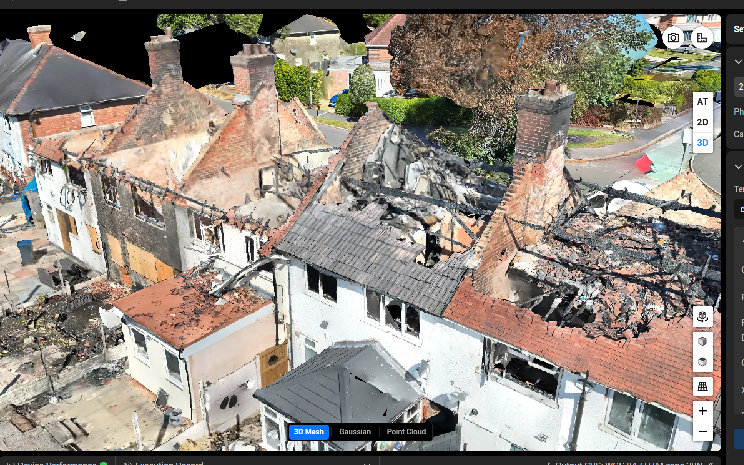
Centimetre-accurate data for construction and engineering.
Surveying & Mapping
We deliver high-resolution topographic surveys, 3D point clouds, and volumetric models using the latest LiDAR and photogrammetry technology — faster and more cost-effectively than traditional methods.
Topographic Surveys
Accurate terrain models for civil engineering, planning applications, and land management.
3D Modelling & Point Clouds
Photogrammetry-derived 3D models and dense point clouds for BIM integration and design.
Volumetric Analysis
Precise stockpile and cut/fill calculations for quarries, construction sites, and earthworks.
Orthomosaic Mapping
Georeferenced aerial maps with centimetre accuracy, delivered in GIS-compatible formats.
Geospatial Data Products
We produce a full suite of geospatial outputs including orthomosaics, Digital Surface Models (DSMs), Digital Elevation Models (DEMs), and classified point clouds — all georeferenced and ready for use in GIS, CAD, and BIM workflows.
Who It's For
- Construction & civil engineering
- Land registry & planning
- Quarry & aggregate management
- Flood risk assessment
- Agricultural land surveys
What You Receive
- GeoTIFF orthomosaics
- Digital Surface Models (DSMs)
- Digital Elevation Models (DEMs)
- LAS/LAZ point clouds
- DXF/DWG CAD files
- 3D mesh models
- Volume reports
Turnaround
48–72 hours from flight
Drone Surveying & Mapping Across the West Midlands
Our surveying and mapping team operates throughout the West Midlands and surrounding counties, covering Birmingham, Solihull, Coventry, Wolverhampton, Dudley, Walsall, Sandwell, and Staffordshire. We work regularly with construction firms, civil engineers, and planning consultants on sites across the region — from large residential developments in Sutton Coldfield to commercial earthworks in the Black Country. The West Midlands is one of the UK's most active construction regions, and our ability to mobilise quickly and deliver centimetre-accurate data within 48–72 hours makes us a practical choice for time-sensitive projects. We also cover Warwickshire, Worcestershire, and Shropshire, and can deploy nationally for larger contracts. If you have a survey requirement in the Midlands, contact us for a no-obligation quote.