Rapid Damage Assessment
Capture an immediate aerial overview of affected buildings, land and access routes without placing people in unnecessary danger.
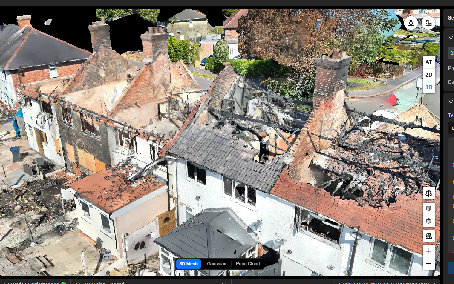
Rapid aerial intelligence when it matters most.
Professional drone surveys give you a clear, safe view of affected areas, helping teams assess damage, identify hazards and plan the next steps with confidence.
Capture an immediate aerial overview of affected buildings, land and access routes without placing people in unnecessary danger.
Spot unstable structures, standing water, debris, heat signatures and other risks that may not be visible from ground level.
Provide detailed imagery and video to support incident records, insurance evidence and informed recovery planning.
Document changes over time with consistent aerial viewpoints as clean-up, repair and recovery work progresses.
Priority scheduling available; deliverables agreed to suit the incident.
Stratus Intelligence provides rapid disaster and risk survey deployments across the West Midlands, covering Birmingham, Coventry, Wolverhampton, Dudley, Walsall, Solihull, and Sandwell. When an incident occurs — whether that is storm damage, a fire, flooding, or a structural failure — having clear aerial intelligence quickly can make a significant difference to how safely and efficiently the response is managed. Our West Midlands base allows us to mobilise at short notice across the region, and we are experienced in operating in complex, sensitive environments where safety and discretion are paramount. We also cover Staffordshire, Warwickshire, Worcestershire, and Shropshire, and can deploy nationally where required. If you need an urgent aerial assessment of a high-risk or damaged site, contact us and we will respond as quickly as possible.